ForeFlight Addons - HOME
Comments? Suggestions?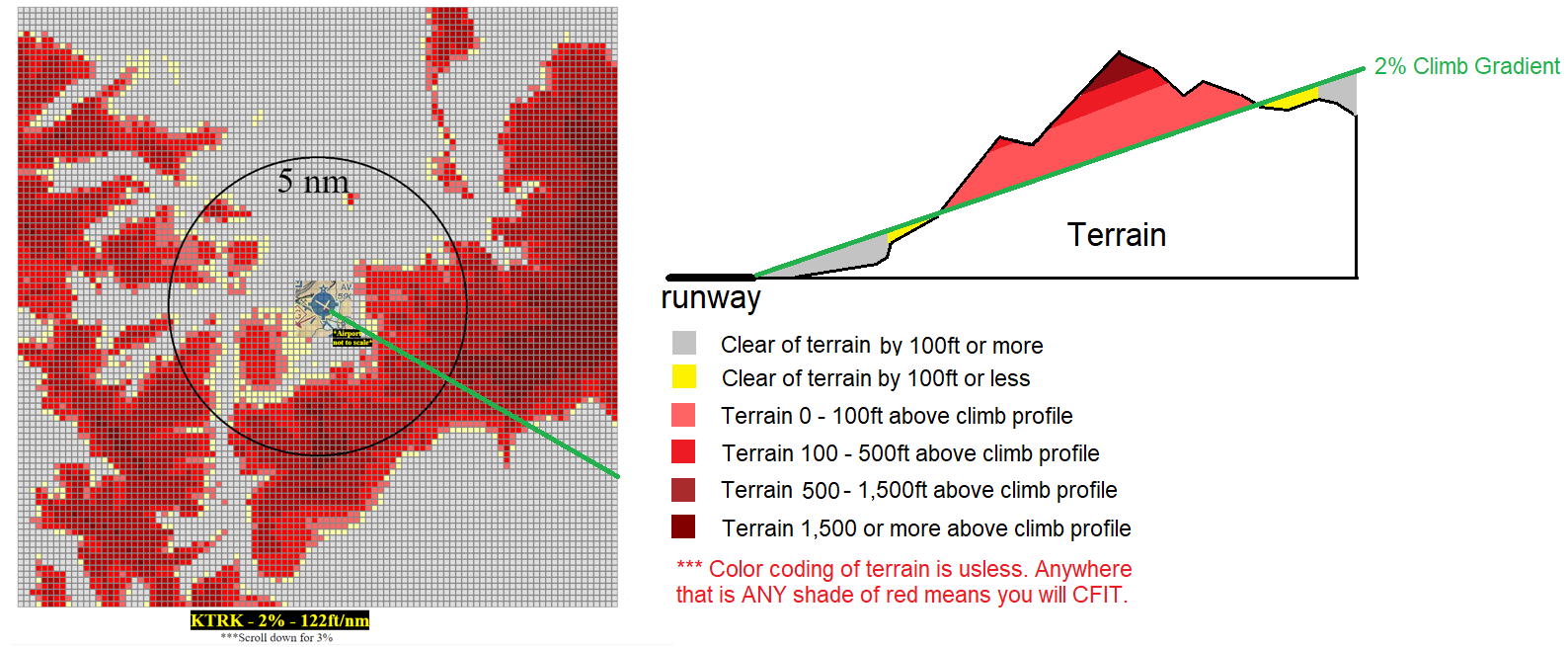
Fun use case:
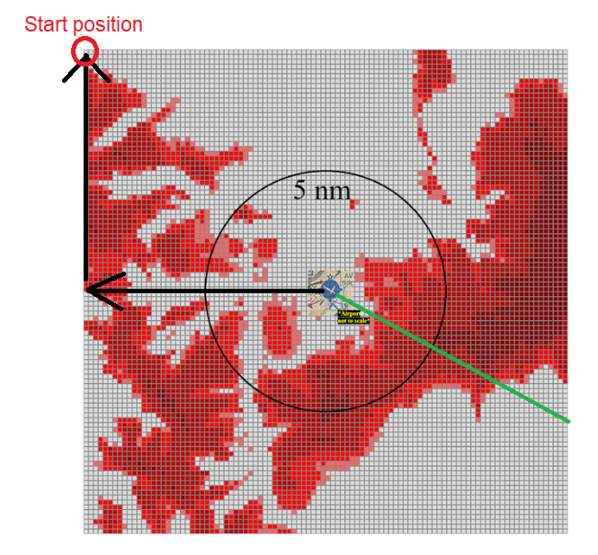
KEGE at 10nm radius.
If you look at all 3 departure procedures for KEGE you will see that a slight left turn right after liftoff.
My AFM shows 1% climb gradient there with zero flap takeoff at 11,850Lbs and 25C
With my tool, you will see that making this left turn is like signing your own death warrant.
To stay alive in case of an engine failure at V1, the only way out is a slight RIGHT turn.
Why I made this tool:
It was a very hot day in vegas and before taking off KVGT to the NW on the NOTWN5 departure I knew that I could not meet the climb requirements if one engine would fail on my Citation 501.
This got me thinking, if it was night and couldn't see the terrain, where would I go? Would I fly straight ahead? Would staying on the SID fly me into the side of a mountain?
Technical Details:
1) I have a database of all airports, their GPS coorinates and field elevation.
2) If you enter radius 10, I will find the new GPS coordinates 10nm east of the airport.
3) From that point, I'll find the new GPS coordinate 10nm north.
4) The grid is hard coded to 100x100 squares. A total of 1,000 squares. 5) Since you have selected 10nm radius, each square will be 0.1nm apart from the next square
6) From the starting point on the grid, I find the elevation using API provided by www.open-elevation.com
7) Then I must go to next square to the right by 0.1nm and find new elevation. Once reaching the 100th square, I go back to the starting position at the top left, and move DOWN 0.1nm and repeate the process till all 1,000 squares have elevation data.
8) To find the distance between each square and the airport, I use the pothagorean theorem.
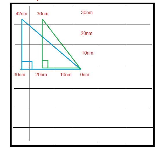
9) The calculations thereafter are simple to decide if terrain is colliding with climb profile.
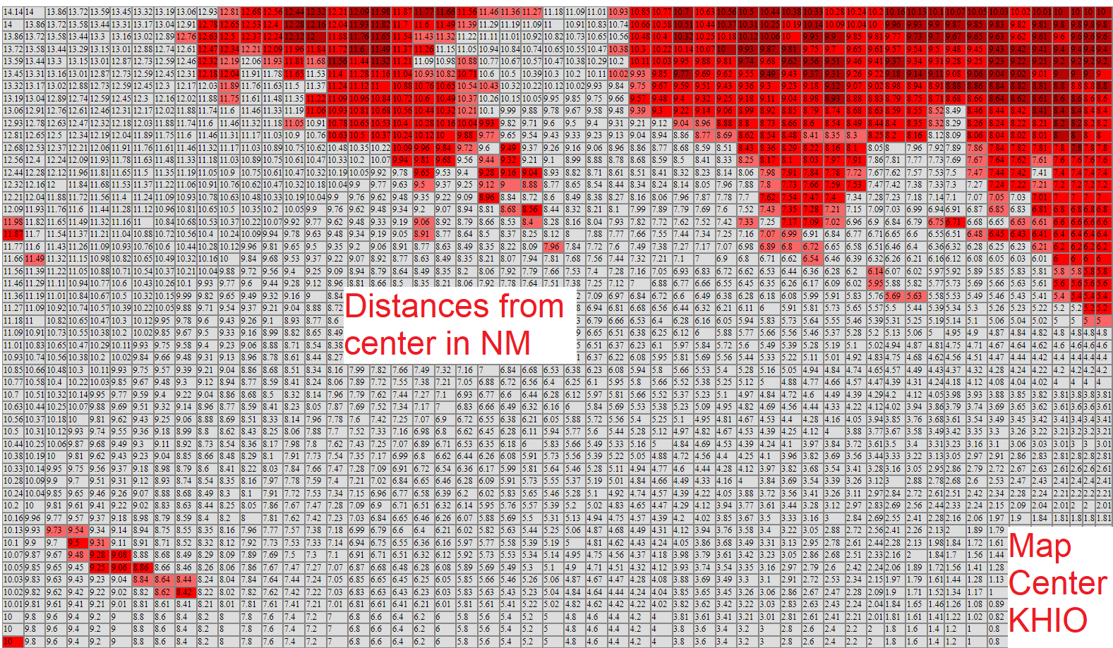
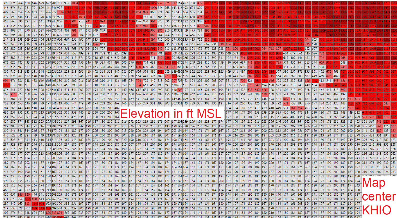
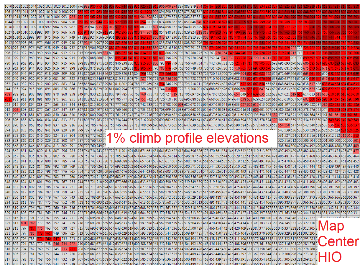
Here are some debugging examples for KHIO:
KEGE at 10nm radius.
If you look at all 3 departure procedures for KEGE you will see that a slight left turn right after liftoff.
My AFM shows 1% climb gradient there with zero flap takeoff at 11,850Lbs and 25C
With my tool, you will see that making this left turn is like signing your own death warrant.
To stay alive in case of an engine failure at V1, the only way out is a slight RIGHT turn.
Why I made this tool:
It was a very hot day in vegas and before taking off KVGT to the NW on the NOTWN5 departure I knew that I could not meet the climb requirements if one engine would fail on my Citation 501.
This got me thinking, if it was night and couldn't see the terrain, where would I go? Would I fly straight ahead? Would staying on the SID fly me into the side of a mountain?
Technical Details:
1) I have a database of all airports, their GPS coorinates and field elevation.
2) If you enter radius 10, I will find the new GPS coordinates 10nm east of the airport.
3) From that point, I'll find the new GPS coordinate 10nm north.
4) The grid is hard coded to 100x100 squares. A total of 1,000 squares. 5) Since you have selected 10nm radius, each square will be 0.1nm apart from the next square
6) From the starting point on the grid, I find the elevation using API provided by www.open-elevation.com
7) Then I must go to next square to the right by 0.1nm and find new elevation. Once reaching the 100th square, I go back to the starting position at the top left, and move DOWN 0.1nm and repeate the process till all 1,000 squares have elevation data.
8) To find the distance between each square and the airport, I use the pothagorean theorem.
9) The calculations thereafter are simple to decide if terrain is colliding with climb profile.
Here are some debugging examples for KHIO: